Images, images and images
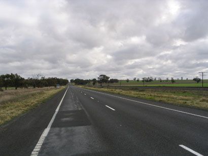
The journey from Melbourne to Adelaide was along the number 8 route. A railway line between Melbourne and Adelaide runs along the road most of the time.
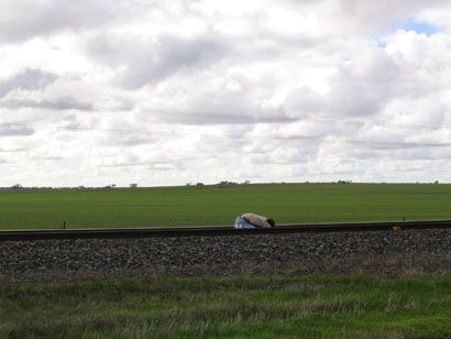
Here, you can see me bending really low to capture an image. I wanted the camera to be pointing horizontally, but as close to the ground as possible. I got a photo or two with the railway tracks on the sides of the photo. Stance inspired by a tai chi quan form.
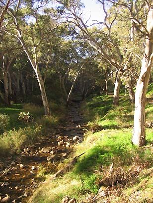
On Tuesday morning, we walked in a reserve park around the Morialta Falls near Adelaide. The waterfall itself was not a very large one, but it dropped from a great height. No good pictures of it.
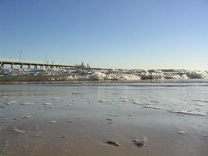
Glenelg is a seaside town in the outskirts of Adelaide. This shot is the kind of thing that requires the camera to be very low near the ground. However, there is no need to bend and squat when using a digital camera’s LCD display.
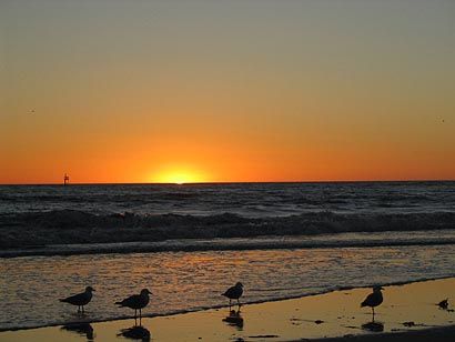
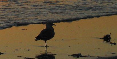
During sunset, a flock of birds came to the waterfront. One of them has only one leg. Note that the leg is slightly bent to keep its centre of mass (gravity) directly above its single feet.
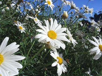
I love macro shots, if you don’t already know.
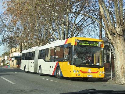
Adelaide uses articulated buses. They are long and jointed like a train. As far as I know, only Volvo makes these buses. This bus is branded Scania, but looks like a Volvo bus nonetheless. Volvo purchased Scania in 1999 or 2000.
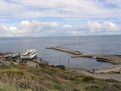
This is the ferry that took to Kangaroo Island. It’s a catamaran, with a capacity of about 40 cars powered by a pair of V12 diesel engines, each producing 1500 bhp.
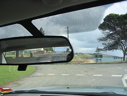
On one particular street in Pennshaw, Kangaroo Island, there is sea at both ends of the street. Look in the rear view mirror for the other bit of sea.
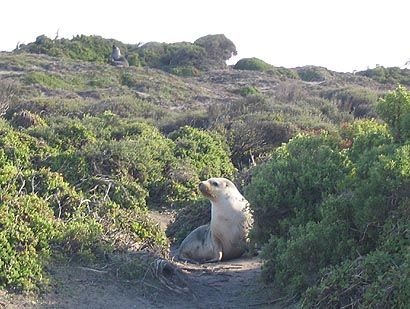
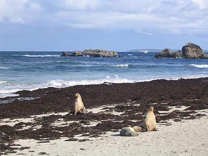
There is a seal colony on Kangaroo Island, and the location has been uncreatively named Seal Bay.
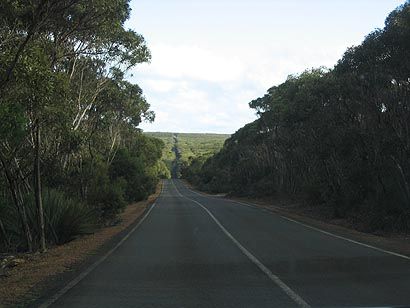
Kangaroo Island is sparsely populated, and has plenty of straight but narrow roads. We saw plenty of road kill- mostly kangaroos and wallabies (small kangaroo-like marsupials).

Click to enlarge.
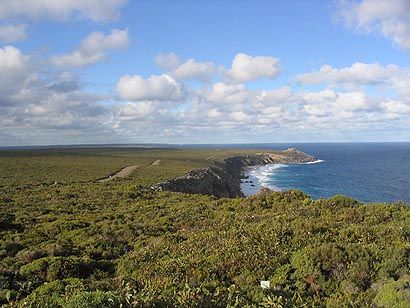
This is on the way to the Remarkable Rocks (another uncreative name). The rocks in question are at the far end of the road, on the top of the little peninsular protruding out to sea. Note the bushes- they are very short, but nonetheless complicated. The second image clearly shows that these short little bushes actually resemble miniature versions of real, normal trees. As such, they often look like a full scale rainforest from afar. Standing above them (they are about knee level), I can get slight tinges of vertigo-like sensations if I convince myself that they are actually forests far below eye level. Very remarkable...
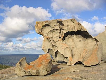
This is part of the Remarkable Rocks formation, a wonder of erosion and weathering.
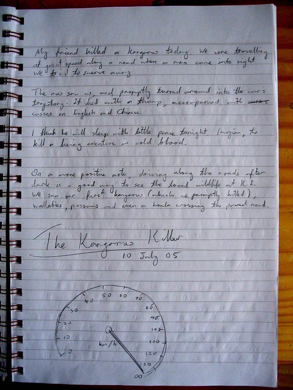
We waited to watch the sunrise before driving back to our hostel. As we blasted along the narrow roads at a prudent speed (just a hair above the speed limit), a kangaroo materialised in the car’s light beam. It was standing on the left side of the road. We moved right to give it some room. The first kangaroo we saw!
The kangaroo saw us, and hopped. Wrong direction, you dolt! It hopped one step, directly into our bumper. Bang! Not even enough time to touch the brake pedal.
The driver (Mr. BZY) was more careful after that incident, and slowed down when there were animals, and gave them even more room. A wallaby hopped across the road; we slowed down while changing lanes. In 3 bounds, it had already crossed the 2 lanes. We had just thought everything was fine when right behind the first animal, a second wallaby followed, just 2 metres behind the first. There was no chance to avoid it. With full brake application, the front tyres squealed as the ABS struggled to hold the wheels along the rain damped surface. Bang!
With 2 deaths in 20 minutes, BZY was naturally freaked out, and CTM took over. There were no further kills.
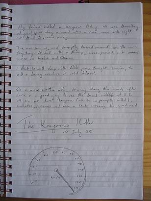
Click to read.
The next morning, I wrote in the hostel’s guestbook. I did not mention the wallaby- 2 kills would make us appear terribly brutal.
We took the 10.30am ferry out of Kangaroo Island and made out way to Mt. Gambier. The roads in the more rural areas were straight and narrow, flanked on both sides with tall brown grass. Behind those grass would be a vast emptiness of some farmland or other. After sunset at 5.30pm, the drive became exceedingly monotonous. The only visible bit was what the headlights illuminated. The grass on both sides look the same all the time. If a car came in the other direction, its lights would be visible from kilometres away, and would take ages for it to arrive even though both vehicles sped towards each other at a combined speed in excess 200+ km/h.
Mt. Gambier is an area of remarkable geology. There is a bed of porous limestone, and ancient volcanic activity blew a crater in the rock. The water table was thus revealed. In summer, the Blue Lake really does take on a blue hue. The water from this lake is so clean that it is pumped into the town’s water supply without any treatment except a slight dose of chlorine as a precaution.
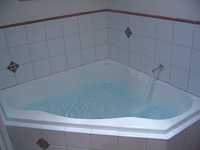
We stayed at a bungalow with a jacuzzi. Note the natural blueness in the water.
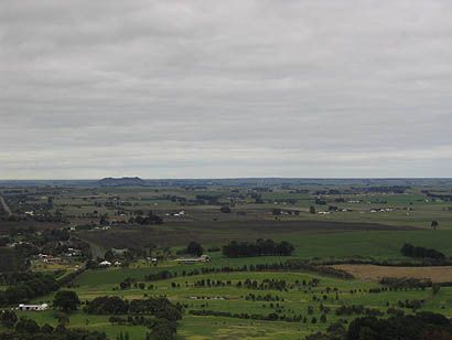
This was from the highest point in the region- 190m above sea level.
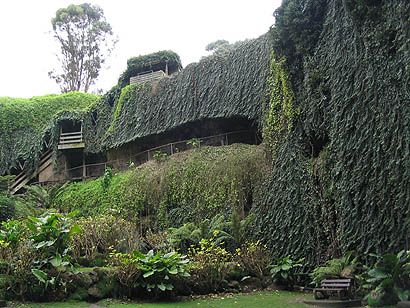
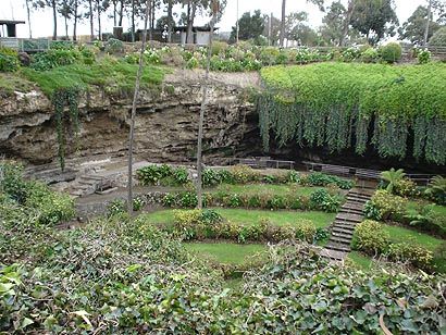
Mt. Gambier has lots of limestone caves. When the roof of a cave collapses, it leaves a hole in the ground- a sink hole. This sink hole has been converted into a garden. The top level of the stairs is actually ground level, and the stairs lead into the hole.
Well, that’s the summary. Sorry for the boring narration; could have been better. Thank you for reading.
Here, you can see me bending really low to capture an image. I wanted the camera to be pointing horizontally, but as close to the ground as possible. I got a photo or two with the railway tracks on the sides of the photo. Stance inspired by a tai chi quan form.
On Tuesday morning, we walked in a reserve park around the Morialta Falls near Adelaide. The waterfall itself was not a very large one, but it dropped from a great height. No good pictures of it.
Glenelg is a seaside town in the outskirts of Adelaide. This shot is the kind of thing that requires the camera to be very low near the ground. However, there is no need to bend and squat when using a digital camera’s LCD display.
During sunset, a flock of birds came to the waterfront. One of them has only one leg. Note that the leg is slightly bent to keep its centre of mass (gravity) directly above its single feet.
I love macro shots, if you don’t already know.
Adelaide uses articulated buses. They are long and jointed like a train. As far as I know, only Volvo makes these buses. This bus is branded Scania, but looks like a Volvo bus nonetheless. Volvo purchased Scania in 1999 or 2000.
This is the ferry that took to Kangaroo Island. It’s a catamaran, with a capacity of about 40 cars powered by a pair of V12 diesel engines, each producing 1500 bhp.
On one particular street in Pennshaw, Kangaroo Island, there is sea at both ends of the street. Look in the rear view mirror for the other bit of sea.
There is a seal colony on Kangaroo Island, and the location has been uncreatively named Seal Bay.
Kangaroo Island is sparsely populated, and has plenty of straight but narrow roads. We saw plenty of road kill- mostly kangaroos and wallabies (small kangaroo-like marsupials).

Click to enlarge.
This is on the way to the Remarkable Rocks (another uncreative name). The rocks in question are at the far end of the road, on the top of the little peninsular protruding out to sea. Note the bushes- they are very short, but nonetheless complicated. The second image clearly shows that these short little bushes actually resemble miniature versions of real, normal trees. As such, they often look like a full scale rainforest from afar. Standing above them (they are about knee level), I can get slight tinges of vertigo-like sensations if I convince myself that they are actually forests far below eye level. Very remarkable...
This is part of the Remarkable Rocks formation, a wonder of erosion and weathering.
We waited to watch the sunrise before driving back to our hostel. As we blasted along the narrow roads at a prudent speed (just a hair above the speed limit), a kangaroo materialised in the car’s light beam. It was standing on the left side of the road. We moved right to give it some room. The first kangaroo we saw!
The kangaroo saw us, and hopped. Wrong direction, you dolt! It hopped one step, directly into our bumper. Bang! Not even enough time to touch the brake pedal.
The driver (Mr. BZY) was more careful after that incident, and slowed down when there were animals, and gave them even more room. A wallaby hopped across the road; we slowed down while changing lanes. In 3 bounds, it had already crossed the 2 lanes. We had just thought everything was fine when right behind the first animal, a second wallaby followed, just 2 metres behind the first. There was no chance to avoid it. With full brake application, the front tyres squealed as the ABS struggled to hold the wheels along the rain damped surface. Bang!
With 2 deaths in 20 minutes, BZY was naturally freaked out, and CTM took over. There were no further kills.
Click to read.
The next morning, I wrote in the hostel’s guestbook. I did not mention the wallaby- 2 kills would make us appear terribly brutal.
We took the 10.30am ferry out of Kangaroo Island and made out way to Mt. Gambier. The roads in the more rural areas were straight and narrow, flanked on both sides with tall brown grass. Behind those grass would be a vast emptiness of some farmland or other. After sunset at 5.30pm, the drive became exceedingly monotonous. The only visible bit was what the headlights illuminated. The grass on both sides look the same all the time. If a car came in the other direction, its lights would be visible from kilometres away, and would take ages for it to arrive even though both vehicles sped towards each other at a combined speed in excess 200+ km/h.
Mt. Gambier is an area of remarkable geology. There is a bed of porous limestone, and ancient volcanic activity blew a crater in the rock. The water table was thus revealed. In summer, the Blue Lake really does take on a blue hue. The water from this lake is so clean that it is pumped into the town’s water supply without any treatment except a slight dose of chlorine as a precaution.
We stayed at a bungalow with a jacuzzi. Note the natural blueness in the water.
This was from the highest point in the region- 190m above sea level.
Mt. Gambier has lots of limestone caves. When the roof of a cave collapses, it leaves a hole in the ground- a sink hole. This sink hole has been converted into a garden. The top level of the stairs is actually ground level, and the stairs lead into the hole.
Well, that’s the summary. Sorry for the boring narration; could have been better. Thank you for reading.
posted by Tan Yee Wei at 7/15/2005 01:38:00 am
![]()
![]()
<< Home